Yellowstone
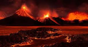
Yellowstone National Park sits on a subterranean chamber of molten rock and gasses so vast that it is arguably
one of the largest active volcanoes in the world. A magma chamber not far below the surface fuels all the
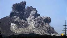
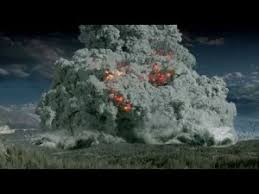
volcanic attractions that Yellowstone is famous for. The last major eruption at Yellowstone, some 640,000
years ago, ejected 8,000 times the ash and lava of Mount St. Helens. It is alive and well today, and is the
scientific basis for the hilarious volcanic explosion seen in the movie 2012 that blew up Woody Harrelson and,
NOT John Cusack. Not sure how that happened.
Background:
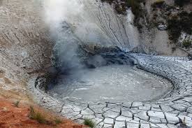
Heat from the mantle plume has melted rocks in the crust, and created two magma chambers of partially molten
partially solid rock near Yellowstone’s surface. Heat from the shallowest magma chamber caused an area of the
crust above it to expand and rise. Stress on the overlying crust resulted in increased earthquake activity along
newly formed faults. Eventually, these faults reached the magma chamber and magma oozed through the cracks.
Escaping magma released pressure within the chamber, which also allowed volcanic gasses to escape and expand
explosively in a massive volcanic eruption. The eruption spewed copious volcanic ash and gas into the atmosphere
and produced fast, super-hot debris flows (pyroclastic flows) over the existing landscape. As the underground
magma chamber emptied, the ground above it collapsed and created the first of Yellowstone’s three calderas.
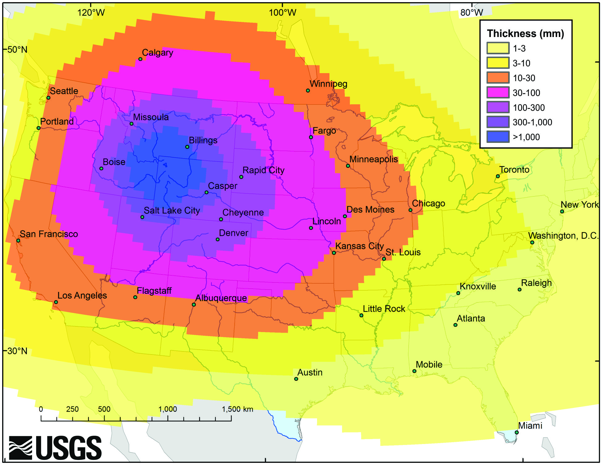
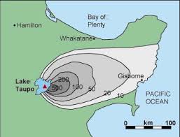
This eruption 2.1 million years ago—among the largest volcanic eruptions known to man—coated 5,790 square miles
with ash, as far away as Missouri. The total volcanic material ejected is estimated to have been 6,000 times
the volume of material ejected during the 1980 eruption of Mt. St. Helens, in Washington.
A second significant, though smaller, volcanic eruption occurred within the western edge of the first caldera
approximately 1.3 million years ago. The third and most recent massive volcanic eruption 640,000 years ago
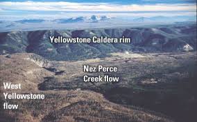
created the present 30- by 45-mile-wide Yellowstone Caldera. Since then, 80 smaller eruptions have occurred.
Approximately 174,000 years ago, one of these created what is now the West Thumb of Yellowstone Lake. During
and after these explosive eruptions huge lava flows of viscous rhyolitic lava and less voluminous basalt lava
flows partially filled the caldera floor and surrounding terrain. The youngest of these lava flows is the
70,000 year old Pitchstone rhyolite flow in the southwest corner of Yellowstone National Park.
Since the last of three caldera-forming eruptions, pressure from the shallow magma body has formed two resurgent
domes inside the Yellowstone Caldera. Magma may be as little as 3–8 miles beneath Sour Creek Dome and 8–12 miles
beneath Mallard Lake Dome, and both domes inflate and subside as the volume of magma or hydrothermal fluids
changes beneath them. The entire caldera floor lifts up or subsides, too, but not as much as the two domes.
In the past century, the net inflation has tilted the caldera floor toward the south. As a result, Yellowstone
Lake’s southern shores have subsided and trees now stand in water, and the north end of the lake has risen into
a sandy beach at Fishing Bridge.
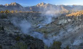
Recently:
Ground deformation has been documented along the central axis of the caldera between Old Faithful and White Lake
in Pelican Valley in historic time. Surveys of suspected ground deformation began in 1975 using vertical-motion
surveys of benchmarks in the ground. By 1985 the surveys documented unprecedented uplift of the entire caldera
in excess of a meter (3 ft). Later GPS measurements revealed that the caldera went into an episode of subsidence
(sinking) until 2005 when the caldera returned to an episode of extreme uplift. The largest vertical movement was
recorded at the White Lake GPS station, inside the caldera’s eastern rim, where the total uplift from 2004 to
2010 was about 27 centimeters (10.6 in).
The rate of rise slowed in 2008 and the caldera began to subside again during the first half of 2010. The uplift
is believed to be caused by the movement of deep hydrothermal fluids or molten rock into the shallow crustal
magma system at a depth of about 10 km beneath the surface. A caldera may undergo episodes of uplift and
subsidence for thousands of years without erupting. Notably, changes in uplift and subsidence have been
correlated with increases of earthquake activity. Lateral discharge of these fluids away from the caldera, and
the accompanying earthquakes, subsidence, and uplift relieves pressure and could act as a natural pressure
release valve balancing magma recharge and keeping Yellowstone safe from volcanic eruptions.
The Future:
WILL YELLOWSTONE ERUPT AGAIN? That is the question. There are many debates on this. Some say it will defintly erupt
over the next thousand or several thousand years. But what about in the next several hundred or sooner. The park service
says no and the USGS points out. "Odds are very high that Yellowstone will be eruption-free for the coming
centuries."
It's also worth noting that the volcanic hotspot underneath Yellowstone is slowly migrating to the northeast
(or, more accurately, the North American tectonic plate above the hotspot is migrating southwest).
On a long enough time scale, the hotspot will move out from under Yellowstone — and the Yellowstone super volcano
would, presumably, die out. Of course, it's possible that another super volcano could emerge further in the
northeast, but the hotspot would first have to heat up and melt the cold crust first. And that process could
take a million years or longer.
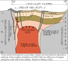
The Long Valley Caldera
Second only to Yellowstone in North America is the Long Valley caldera, in east-central California.
The 200-square-mile caldera is just south of Mono Lake, near the Nevada state line. The biggest eruption
from Long Valley was 760,000 years ago, which unleashed 2,000 to 3,000 times as much lava and ash as Mount
St. Helens, after which the caldera floor dropped about a MILE, according to the U.S. Geological Survey.
Some of the ash reached as far east as Nebraska.
What worries geologists today was a swarm of strong earthquakes in 1980 and the 10-inch rise of about 100
square miles of the caldera floor. Then, in the early 1990's, large amounts of carbon dioxide gas from magma
below began seeping up through the ground and killing trees in the Mammoth Mountain part of the caldera. When
these sorts of signs are present, it could mean trouble is centuries, decades, or even YEARS away, say
volcanologists.
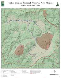
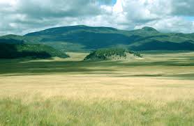
The Valles Caldera
The 175-square-mile Valles caldera forms a large pock in the middle of northern New Mexico, west of Santa Fe.
It last exploded 1.2 million and 1.6 million years ago, piling up 150 cubic miles of rock and blasting ash as
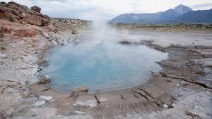
far away as Iowa. As with other calderas, there are still signs of heat below: hot springs are still active
around Valles.
Geologists suspect the cause of Valles caldera has something to do with how the western United States' portion
of the North American tectonic plate is being pulled apart.
Lake Toba Caldera
The 1,080-square-mile Toba caldera in North Sumatra, Indonesia is the only supervolcano in existence that can
be described as Yellowstone's "big" sister. About 74,000 years ago, Toba erupted and ejected several thousand
times more materials than what had erupted from Mount St. Helens in 1980. Some researchers think that Toba's
ancient super-eruption and the global cold spell it triggered might explain a mystery in the human genome.
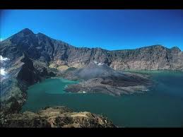
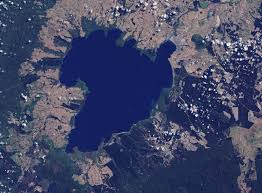
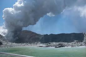
The Taupo Caldera
New Zealand's Taupo caldera has been filled by water, creating what many describe as one of the world's most
beautiful landscapes, but the lake itself was created by a massive eruption 26,500 years ago. The caldera — the
collapsed and subsided basin left after the huge eruption — became today's lake. But Taupo is not dead.
The 485-square-mile caldera let loose again in the year A.D. 181, with estimates of ash and magma reaching as
high as 22 cubic miles.
Today, there are plenty of signs of current volcanic activity in the form of hot springs and venting.
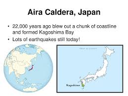
The Aira Caldera
One of the most troubling calderas in the world is the 150-square-mile Aira caldera in southern Japan, on the
edge of which sits the city of Kagoshima. 22,000 years ago 14 cubic miles of material spit out of the ground
formed the Aira caldera, which is now largely Kagoshima Bay. That is equal to about 50 Mount St. Helens eruptions.
The Sakura-jima volcano, which forms part of the Aira caldera, has been active on and off for the past century
and still causes earthquakes today, indicating that the caldera itself is far from sleeping.
The El Garita Caldera
Garita Caldera is a large super volcanic caldera in the San Juan volcanic field in the San Juan Mountains
near the town of Creede in southwestern Colorado, United States. The eruption that created the La Garita
Caldera is among the largest known volcanic eruptions in Earth’s history.
The La Garita Caldera is one of a number of calderas that formed during a massive flare-up in Colorado,
Utah and Nevada from 40–18 million years ago, and was the site of massive eruptions about 28.01±0.04
million years ago, during the Oligocene Epoch.
The scale of La Garita volcanism was the second greatest of the Cenozoic Era. The resulting ash flows the
volcano created, most notably the “Fish Canyon Tuff” has a volume of approximately 1,200 cubic miles
(5,000 km3), giving it a Volcanic Explosivity Index rating of 8. By comparison, the eruption of Mount St.
Helens on 18 May 1980 was 0.25 cubic miles (1.0 km3) in volume.
The Cerro Guacha Caldera
Cerro Guacha is a Miocene caldera in southwestern Bolivia’s Sur Lípez Province. Part of the volcanic
system of the Andes, it is considered to be part of the Central Volcanic Zone (CVZ), one of the three
volcanic arcs of the Andes, and its associated Altiplano-Puna volcanic complex (APVC).
Cerro Guacha and the other volcanoes of that region are formed from the subduction of the Nazca plate
beneath the South America plate. Above the subduction zone, the crust is chemically modified and
generates large volumes of melts that form the local caldera systems of the APVC.
Two major ignimbrites, the 5.6-5.8 mya Guacha ignimbrite with a volume of 1,300 cubic kilometres
(310 cu mi) and the 3.5-3.6 mya Tara ignimbrite with a volume of 800 cubic kilometres (190 cu mi)
have erupted from Cerro Guacha. More recent activity occurred 1.7 mya and formed a smaller ignimbrite
with a volume of 10 cubic kilometres (2.4 cu mi).
The larger caldera has dimensions of 60 by 40 kilometres (37 mi × 25 mi) with a rim altitude of 5,250
metres (17,220 ft). Extended volcanic activity has generated two nested calderas, a number of lava
domes and lava flows and a central resurgent dome.
The Cerro Galan Caldera
Cerro Galán is a caldera in the Catamarca Province of Argentina. It is one of the largest exposed
calderas in the world and forms part of the Central Volcanic Zone of the Andes.
Volcanic activity at Galán is the indirect consequence of the subduction of the Nazca Plate beneath
the South America Plate.
The caldera was active between 5.6 and 4.51 million years ago with the largest eruption occurring
2.08 ± 0.02 million years ago producing 1,050 km3 of deposits.
The Island Park Caldera
The Island Park Caldera crosses the borders of Idaho and Wyoming in the United States and is one of
the world’s largest calderas, with approximate dimensions of 80 by 65 km.
The eruptions ash fall is the source of the Huckleberry Ridge Tuff that is found from southern California
to the Mississippi River near St. Louis. This super-eruption of approximately 2,500 km3 (600 cu mi)
occurred 2.1 Ma (million years ago) and produced 2,500 times as much ash as the 1980 eruption of
Mount St. Helens.
The Island Park Caldera is sometimes referred to as the First Phase Yellowstone Caldera or the
Huckleberry Ridge Caldera.
The Vilama Caldera
Vilama is a Miocene caldera in Bolivia and Argentina. Straddling the border between the two countries,
it is part of the Central Volcanic Zone, one of the four volcanic belts in the Andes. Vilama is remote
and forms part of the Altiplano-Puna volcanic complex, a province of large calderas and associated
ignimbrites that were active since about 8 million years ago, sometimes in the form of super volcanoes.
Vilama is the source of the enormous Vilama ignimbrite, which was emplaced during an eruption with a
volcanic explosivity index of 8 about 8.4–8.5 million years ago. A large amount of the Vilama ignimbrite
is inside the caldera depression, while the part outside of the caldera covers a surface area exceeding
4,000 square kilometres (1,500 sq mi). The total volume of the ignimbrite is about 1,200–1,800 cubic
kilometres (290–430 cu mi), possibly as much as 2,100 cubic kilometres (500 cu mi). Another large
ignimbrite, the Sifon ignimbrite, may also have been erupted by Vilama, while the Granada ignimbrite
was later attributed to a separate volcano.
The La Pacana Caldera
La Pacana is a Miocene age caldera in northern Chile’s Antofagasta Region. Part of the Central Volcanic
Zone of the Andes, it is part of the Altiplano-Puna volcanic complex, a major caldera and silicic
ignimbrite volcanic field.
La Pacana along with other regional volcanoes was formed by the subduction of the Nazca Plate beneath
the South American Plate in the Peru-Chile Trench. La Pacana is responsible for the eruption of the
giant Atana ignimbrite, which reaches a volume of 2,451–3,500 cubic kilometres (588–840 cu mi) and
constitutes the fifth-largest explosive eruption known. The Atana ignimbrite was erupted 3.8 ± 0.1
and 4.2 ± 0.1 million years ago, almost simultaneously with the much smaller (volume of 180 cubic
kilometres (43 cu mi)) Toconao ignimbrite.
The Pastos Grandes Caldera
Pastos Grandes is the name of a nested caldera and crater lake in Bolivia which is around 35 by
40 kilometres (22 mi × 25 mi) wide and has a maximum depth of 400 metres (1,300 ft).
The caldera is part of the Altiplano-Puna volcanic complex, a large ignimbrite province that is part
of the Central Volcanic Zone of the Andes.
Pastos Grandes has erupted a number of ignimbrites through its history, some of which exceeded a
volume of 1,000 cubic kilometres (240 cu mi). After the ignimbrite phase, the lava domes of the
Cerro Chascon-Runtu Jarita complex were erupted close to the caldera and along faults.